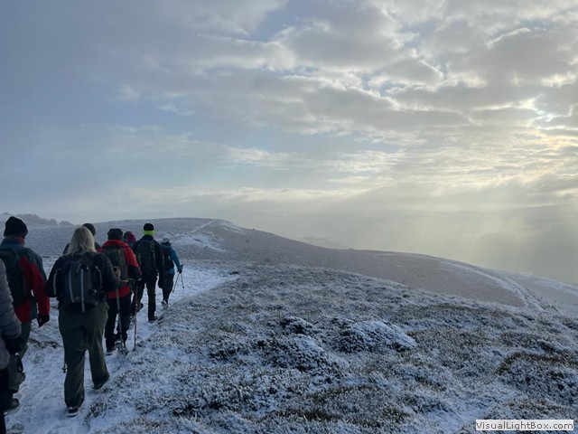
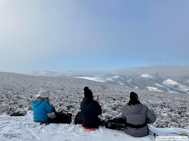
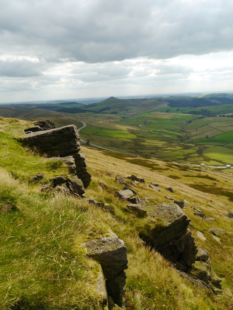
Sunday 12th January 2025 6:30am Lathkill Dale Derbyshire

Cost of this walk is £14.00 for members and £16.00 for visitors
Walk Organiser – Neville Village
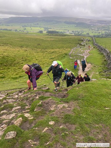
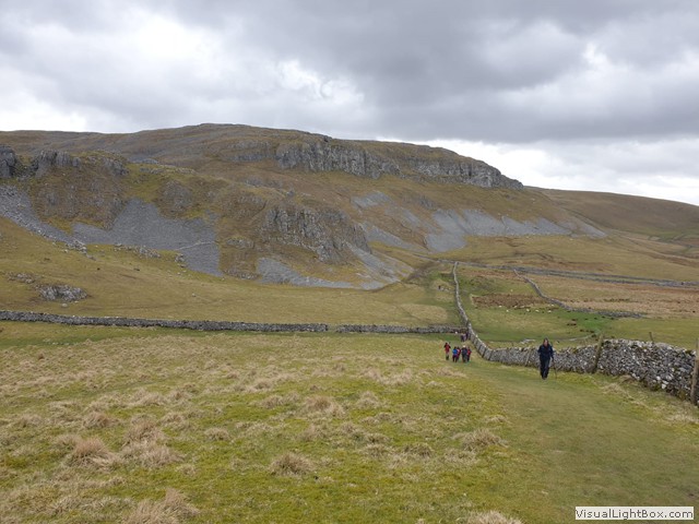
Lathkill Dale is a Limestone Valley situated about 3 miles from Bakewell where the river emerges from Lathkill Head Cave which disappears during drought and summer and is due to old Lead workings dating back to at least the 13th century, which draws the water underground. The Dale also has several historic bridges and old mill remnants i.e. Carters Mill, with the medieval bridge at Conksbury and nearby deserted medieval settlements recorded in The Domesday Book.
The A Walk starts from Rowsley Car Park and heads South to Endcliffe Quary then turns North to visit Nine Ladies Stone Circle. Heads South to Upper Town, then Eastwards past Birchover and turns Southeast to Elton. The walk then heads North up to Alport and then Over Hadden. Then turns West into Lathkill Dale, heads North past Mill Farm then Southeast returning to Lathkill Dale, then East through Fern Dale and finally Northeast along the Limestone Way to the finish at Moneyash Car Park.
Leaders: Carol Gosling and Tom Somervell
Distance: 25Km Height Gain: 820m
The B1 Walk starts from Rowsley Car Park and heads Southeast to Congreave onto Stanton Peak continuing to the Kings Stone, past Birchover and Upper Town, and turns Northeast to Robin Hoods Stride along the Limestone Way to Bradford and then Northeast past Youlgreave continuing Northeast into Lathkill Dale and past Ricklow Quarry to turn Southeast into Fern Dale and finally Northeast along the Limestone way to the finish at Monyash Car Park.
Leaders: Bob Price and Ian Broughton
Distance: 22Km Height Gain: 700m
The B2 Walk also starts from Rowsley Car Park and heads Northeast towards Low Moor Wood before turning East past Haddon Park Farm and then Southeast to Cronksbury. South past Alport and Bradford, then following the River Bradford past Castle Farm to Middleton. Heads North past Lomberdale Hall turning Northeast along the Limestone Way into Lathkill Dale. Heads Northeast past Ricklow Quarry and turn sharply Southeast at Fern Dale towards One Ash Grange Farm then Northeast to follow the Limestone way as the A and B1 groups to the finish at Monyash Car Park.
Leaders: Keith and Elaine Richards
Distance: 21Km Height Gain: 625m
The C Walk also starts from Rowsley Car Park and heads Southeast to Congreave, then South to Stanton Hall before turning East to Alport. Then Northwest along the River Lathkill past Conksbury Village towards Over Haddon following Lathkill Dale and heading Northeast past One Ash Grange Farm, then joins the Limestone Way past Fern Dale continuing as the A and B groups to the finish at Monyash Car Park.
Leaders: Wendy Price and Neville Village
Distance: 15Km Height Gain: 450m
Map: 1:25000 Explorer OL24 The White Peak
Memories from the 50 years of Hill Walking Club
…............wonderful flavoured icecreams at the farm at the bottom of the Howgills, Sedburgh-marmalade and whisky was one Carol G
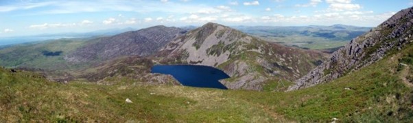
Sunday 16 March 2025 6:00am Aran Mountains

North Wales - The Arans - Sunday 16th March 2025
(Cost of this walk is £15.00 for members and £17.00 for visitors)
Walk Organiser - Anne Farmer Coach leaves at 6.00am
The Aran mountains form a long rocky ridge with Aran Fawddwy as the highest peak in the mountain range, the only peak in Wales outside North Snowdonia above 900m and the 16th highest summit inWales, but Aran Benllyn is another notable summit. The eastern side is extremely steep, falling spectacularly in crags to a series of glacial cwms or corries which also enclose two small lakes (Creiglyn Dyfi and Llyn Lli-wbran). To the north the main peaks of Snowdon rise proudly; to the west you can see the lovely coastline of Cardigan Bay. South lies the remote massif of the Cambrian Mountains; and eastwards twinkle the waters of Bala Lake. This will be the club’s sixth visit to the Arans. The walks will include all of the main summits.
Our walks all finish at Dinas Mawddwy.
The A Walk starts from Llanuwchllyn heading across fields initially and climbs gently in a southerly direction across Garth Fawr,(332m) from there continues to the summit of Moel Ffenigl (603m) and across Craig y Llyn continuing south across Aran Benllyn (885m)and Aran Fawddw (905m) then gently descending across the Tyllau Mwn levels (610m) before steeply climbing again to the Cairn and small lake at Glasgwm. (772m) From there the steady descent continues across Craig Cywarch to join a track through pine forests to Pentrewern , before following the river valley to the finish at Dina Mawddwy.
Leaders: Tom Somervell and Scott Rumbold
Distance: 22.4 Km Height Gain: 1042m Descent: 1118m
The B1 Walk starts at Llanuwchllyn heading across fields initially and climbs gently in a southerly direction across Garth Fawr, (332m) continuing a gentle ascent across Moel Ddu, (430m) Craig y Geifr, Moel Ffenigl, (603m), Aran Benllyn (885m) and Aran Fawddw (905m), before turning south east gently descending through Drws Bach and across Drysgol (745m). It then turns south west a to continue a gradual descent across Waun Goch and steeply to the valley at Cywarch before continuing southwards in the valley of Cwm Cywarch along tracks to the finish at Dina Mawddwy
Leaders: Bob Price and Anne Farmer
Distance: 19.4Km Height Gain: 878m Descent: 954m
The B2 Walk Starts near Wenallt on the A494 going along a lane towards Esgair-gawr before climbing gently eastwards initially through woodland and then more steeply to the summit of Aran Fawddw (905m). Steps are then briefly retraced to descend gently through Drws Bach across Drysgol (745m) and then turning south west to continue a gradual decent across the side of Waun Goch and steeply to the valley at Cywarch, before continuing southwards in the valley of Cwm Cywarch along tracks to the finish at Dina Mawddwy.
Leaders: Neville Village and Dennis Haycox
Distance: 17.2Km Height Gain: 815m Descent: 873m
The C Walk starts from the A470 and directly climbs steeply up Ochr Y Bwich to 509m. The climb continues more gently north east to the summit of Pen y Brynfforchog (685m) and around the edge of woodland to the summit of Glasgwm (779m). Then descending southwards, and winding south west to join a track through pine forests to Pentrewern, before following the river valley to the finish at Dina Mawddwy.
Leaders: Wendy Price and Rob Maule
Distance: 15.4Km Height Gain: 528m Descent:796m
Maps: 1:25000 Explorer OL23
Sunday14th December 2025 Coach Leaves 7:00am
Llangollen
Llangollen is a town and community situated on the River Dee in Denbighshire, Wales. Its riverside location forms the edge of the Berwyn Range and the Dee Valley section of the Clwydian Range and Dee Valley Area of Outstanding Natural Beauty. The area is rich in history with evidence of both Bronze and Iron Age activity, castle and abbey ruins, more recent industrial workings and the canal and railway bringing transport to the region. It is a walker’s paradise with hills to the north and south, the impressive Eglwyseg limestone escarpment, visible as a white scar on the landscape and long distance paths, the Dee Valley Way, Berwyn Way, Offas Dyke Path and the Clwydian Way all accessible. Our walks will encompass some of these trails as we explore the area before we return to the Wild Pheasant Hotel for our annual dinner.
Map ……………………………...………..…Explorer 255 Llangollen and Berwyn
Walk Details……..………………….……….……………....…………Carol Gosling
Memories from the 50 years of Hill Walking Club
.........Bernard, our club comedian, set up as a guest performer with a "One Night Only" poster displayed, at the Bower House on a February weekend. A family waited all night in the bar for his appearance.........!
Sunday 8th June 2025 6:00am Nantlle Ridge, Mynydd Mawr

Cost of this walk is £18.00 for members and £20.00 for visitors
Walk Oganiser Rob Maule
The Nantlle Ridge, this often-overlooked Snowdonia mountain range, makes for an exciting ridge walk. Just a stone’s throw from the summit of Snowdon, on the western side of the A4085 Beddgelert to Caernarfon Road, lies Snowdonia’s westernmost mountain range.
Moel Eilio and Foel Goch – a roller coaster route over Snowdon’s quieter neighbours on the western flanks of Snowdon. Moel Eilio’s summit is flat and a shelter is a noticeable feature. Even more noticeable on a clear day are the views taking in mountain and coast panoramas.
Mynydd Mawr (Welsh for 'Big Mountain') Which overlooks Llyn Cwellyn and is the northern outlier of the Moel Hebog group. On its western flank are the remains of ancient settlements and field ystems. The profile of Mynydd Mawr from the north is often thought to resemble an elephant lying down.
Walks A and B1 are not recommended for those of you who do not have a head for heights or are not comfortable with exposed edges on this route that involves a grade 1 scramble.
A WALK Nantlle Ridge
This starts 0pposite the Rhyd Ddu carpark (SH 570 525) follow the footpath due west leading to a steep climb to the summit of Y Garn, from here follow the ridge SSW taking care with the steep scramble towards Mynydd Drws-Y-Coed. Keep ahead into the next col and continue up onto Trum y Ddysgl.At SH 543 515 the path turns predominantly west and head onto the obelisk at the summit of Mynydd Tal-y-Mignedd, the route turns SW towards Bwlch Dros-bern and Craig Pennant. After this you reach the highest point of the day of 734m at the cairn. A sharp change of direction at SH 518 499 will start the descent towards Beudy Newedd and onto the valley path to Beudy’r Ddol and Cwm Trwsgl follow this path onto the Beddgelert Forest. Through the forest onto open ground and continue the descent into Rhyd Ddu.
Leaders: Tom Somervell and Ranjit Bindarh Distance: 17k -Ascent 1230m
B1 WALK Nantlle Ridge
Start at Cae Gors SH 575 508 enter the Beddgelert forest follow the track for around 120m before turning North follow the Snowdonia Slate Trail through the forest and along the edge of Llyn y Gader as far as SH 567 524. Turn left and join the A route, first climbing to Y Garn 633m. Continue to follow the ridge taking care on the ascent of Mynydd Drws-y coed a grade 1 scramble with exposed edges, as far as the obelisk at Mynydd Tal-y-migned. Here you re trace the route as far as SH 543 514, then taking what should be an obvious grassy spur on your right you will be starting your descent along the edge of the forest on your left, Continue into the remote Bwlch-y-Ddwy-elor, to a gate on the left, around here you will find remnants of the Cwm Trwsgl quarries. Like the A group follow the track through the forest and onto open ground and continue the descent into Rhyd Ddu.
Leaders: Bob Price and Sonia Smalling Distance: 14k- Ascent 845m
B2 Walk Moel Eilio Ridge
Start from the carpark at Tafarn Snowdonia Parc SH 526 588, turn right from the carpark towards the village of Waunfawr taking care walking on the main A4085 to cross the bridge over the Afon Gwyrfai, take the footpath on the left to pass through the southern edge of the village. The route joins the Snowdonia Slate Trail heading E to SH 557 599 Bwlch-y-groes turn S to Bryn Mawr and onto Moel Eilio 726m. Continue over Bwlch Gwyn and Bwlch Cwm Cesig reaching a height of 629m and down to Foel Gron at 593m and Foel Goch 605m. The route then turns SSE over Bwlch Maesgwm and crosses the Snowden Ranger Path at SH 575 553. The route becomes more southerly as you descend towards Clogwyn-y-gwin where the path turns SW to finish at Rhyd Ddu.
Leaders: Dennis Haycox and Paul Burns Distance: 14.2k – Ascent 775m
C WALK Mynydd Mawr
Start from the carpark at Tafarn Snowdonia Parc SH 526 588, turn left from the carpark away from the village of Waunfawr taking care walking on the main A4085. In a few metres take the minor road on the right climb steadily to the view point over looking Caernarfon, Menai Straites and Anglesey, take care this road is used by local traffic. The route now turns towards Moel Smyth and joins the Snowdonia Slate Trail at SH 520 571 for a short distance, leaving it at SH 525 560 heading S and then sharply E. On a clear day the ascent of Mynydd Mawr can be easily seen, a steady and continuous ascent leads you to the summit of Myndd Mawr reaching the height of 698m. We now start to descend steadily past Craig y Bera and over Foel Rudd at 573m. The views along this sweeping ridge can be stunning. Following a steep descent we enter the Beddgelert forest and rejoin the Slate Trail, which takes us into Rhyd Ddu.
Leaders: Wendy Price and Rob Maule Distance: 11.5k – Ascent 645m
…......Sonia falling into a peat bog on a Lakes weekend in February. She was there one moment then covered the next. “Dawn French ,Vicar of Dibley jumping into the puddle that came to her head!!” was the Whats App post. Sarah T
Sunday 13th July 2025 6:00am Ingleborough/Whernside

Walk Organiser - Tom Somervell
Cost of this months walk is £20 members £22 non members
All our walks finish at Ingleton, next to the Community Centre (OS grid ref. SD69457295).
The A Party start on the B6255 Low Sleights Road near the Old Hill Inn (OS grid ref. SD74307765), heading North along Philpin Lane, past Long Stack onto ‘A Pennine Journey’ path, up a steep ascent to gain the ridge, and then over High Pike to the summit of Whernside (736m, the highest point of the day). We continue North along the ridge, then veer East and eventually South as we drop down to cross the railway at Little Dale, then past Bleamore Sidings and the Ribblehead viaduct to Ribblehead. We cross the B6255 passing under the railway bridge and take the track that leads South-East through the disused quarry (now a nature reserve) and across Gauber High Pasture towards Colt Park. We then head South-West up over Park Fell (563m), past Black Rock and over Simon Fell before making the final ascent to the summit plateau of Ingleborough (724m). We then continue in a West-South-West direction on ‘A Pennine Journey’ past Quaking Pot and Red Galt Head to the Fell Lane track down to the finish at Ingleton.
Leaders: Matthew Lumley and Tom Somervell
Distance: 24km Ascent 1025m, Descent 1165m
The B1 Party start at Ribble Head on the B6255 (SD76407910), and head North-West following the ‘Three Peaks’ path past Ribblehead viaduct and continuing Northwards past the Bleamoor Sidings to Little Dale. After crossing the railway we continue North-West up Slack Hill, then following the path as it turns West, and then South to gain the ridge that leads to the summit of Whernside (736m, the highest point of the day). We continue South along the ridge, before dropping steeply down to the track that leads to Philpin Lane. After crossing the B6255 we head South past Highwood Pasture and ascend over Humphrey Bottom and steeply up to gain the ridge. Turning West-South-West we continue up to the summit plateau of Ingleborough (724m) and then follow ‘A Pennine Journey’ past Quaking Pot and Red Galt Head to the Fell Lane track down to the finish at Ingleton.
Leaders: Anne Farmer, Ian Broughton and Bob Price
Distance: 20.5km Ascent 940m, Descent 1085m
The B2 Party start on the B6255 Low Sleights Road by Chapel-le-Dale (OS grid ref. SD73857720) and head North-West before turning North-East along the Dales High Way past Bruntscar, Ivescar and Winterscales Farm. After passing underneath the railway, we turn South past the Ribblehead viaduct to Ribblehead, where we cross the B6255 passing under the railway bridge. We take the track that leads South-East through the disused quarry (now a nature reserve) and across Gauber High Pasture towards Colt Park. We then head South-West over Park Fell (563m) and on past Black Rock over Simon Fell before making the ascent to the summit plateau of Ingleborough (724m – the highest point of the day). We then continue in a West-South-West direction following ‘A Pennine Journey’ past Quaking Pot and Red Galt Head to the Fell Lane track down to the finish at Ingleton.
Leaders: Elaine Richards and Keith Richards
Distance: 19.5km Ascent 680m, Descent 790m
The C Party start at Ribble Head on the B6255 (SD76407910), passing under the railway bridge and taking the track that leads South-East through the disused quarry (now a nature reserve) and across Gauber High Pasture towards Colt Park. We then head South-West over Park Fell (563m) and on past Black Rock over Simon Fell before making the ascent to the summit plateau of Ingleborough (724m – the highest point of the day). We then continue in a West-South-West direction following ‘A Pennine Journey’ past Quaking Pot and Red Galt Head to the Fell Lane track down to the finish at Ingleton.
Leaders: Wendy Price and Neville Village
Distance 13km Ascent 520m, Descent 675m
Map - OS 1:25000 Explorer OL2 – Yorkshire Dales – Southern & Western Area.
Memories from the 50 years of Hill Walking Club
….....coach driver Chris, turning the coach round on a sixpence in a very narrow walled lane, near Castleton-must have been a twenty point turn! Carol G
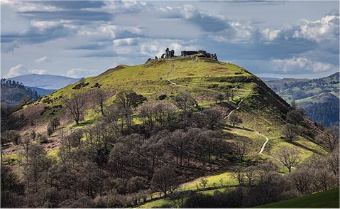
Sunday 10th August 2025 6:00am The Rhinogydd – North Wales
Walk Organisers - Bob Price and Rob Maule. Coach departs at 6.00am
(Cost of this walk is £19.00 for members and £21.00 for visitors)
These are wonderful Snowdonia walks that explore the rocky and wild terrain of the northern Rhinogs. The walks feature a traverse of the northern ridge of the Rhinogs, a chaos of mini crags and heather, with scatterings of little lakes, a little-trodden and remote area of Snowdonia. The terrain is frequently rugged and pathless and can be very tricky underfoot.
The northern Rhinogs present some of the roughest and toughest walking to be found anywhere in Wales, the walks reflect this, with all of them involving a small amount of easy scrambling. However despite these difficulties, this is a superb part of Snowdonia that only a few walkers visit.
Gaiters recommended for all walks
The A walk starts near Pont y Grible (SH713307) goes west passing by Graigddu-isaf and continues towards the Roman Steps turns north east over the crags passing Llyn Pryfed and Llyn Twr-glas then climbs Bwlch Gwylim and continues northwards over Craig Ddrwg, passing Llyn Corn-ystwc and Llyn Ddu on the way to the summits of Moel Ysgyfarnogod and Foel Penolau. Turning north east crosses Diffwys to the summit of Moel y Gyrafolen the walk then descends to join the minor road towards Trawsfynydd at spot height 218, turns south east to the junction with the A470, turns left and continues to the layby and the awaiting coach. (SH711352).
Leaders: Carol Gosling and Tom Somervell.
Distance: 20.5Km Ascent: 850m Descent: 820m
The B1 walk (Clockwise) starts near Cefn-gallt-y-cwm (SH710345) where the minor road is followed and the left fork taken to the settlement, the walk then follows a track to Wern-fach, turns west and crosses an area of marshy ground after which the walk climbs to the summit of Clip via Bwlch Gwylim. The walk continues northwards over Craig Ddrwg, passing Llyn Corn-ystwc and Llyn Ddu over the crags on the way to the summits of Moel Ysgyfarnogod and Foel Penolau. Turning north east crosses Diffwys to the summit of Moel y Gyrafolen, the walk then descends to join the minor road towards Trawsfynydd at spot height 218, turns south east to the junction with the A470, turns left and continues to the layby and the awaiting coach. (SH711352).
Leaders: Bob Price and Louise Tidman.
Distance: 17.5Km Ascent: 660m Descent: 660m
The B2 walk (Anti-clockwise) also starts near Cefn-gallt-y-cwm (SH710345) where the minor road is followed past Tyn Twll to spot height 218, turns west and climbs to the summit of Moel y Gyrafolen. Continuing west and south the walk goes over Diffwys to climb the summits of Foel Penolau and Moel Ysgyfarnogod then over the crags and Craig Ddrwg to Bwlch Gwylim and the summit of Clip. A steep descent follows then the walk continues to descend to cross the marshy ground to Wern-fach and follows the track, then the minor road towards Trawsfynydd and the A470, turns left at the junction and continues to the layby and the awaiting coach. (SH711352).
Leaders: Rob Maule and Paul Burns.
Distance: 17.5Km Ascent: 660m Descent: 660m
The C walk also starts near Cefn-gallt-y-cwm (SH710345) where the minor road is followed past Tyn Twll to spot height 218, turns west and climbs to the summit of Moel y Gyrafolen. Continuing west and south the walk goes over Diffwys to climb the summit of Foel Penolau. A steep and pathless descent follows to join a track which is taken to the minor road near Cefn Clawdd that leads towards Trawsfynydd and the A470, turns left at the junction and continues to the layby and the awaiting coach. (SH711352).
Leaders: Wendy Price and Neville Village.
Distance: 14Km Ascent: 500m Descent: 500m
Maps: 1:25000 OL18. Harlech, Porthmadog and Bala.
Memories from the 50 years of Hill Walking Club
…..........a very windy, snowy recce on High Street (Lakes), when it was 3 steps up and 2 down, John C lost one of his newly acquired snow chains (very early design) and Bob had his glasses blown off, never to be found. Richard G
Sunday 14th September 2025 6:00am The Moelwynion - Snowdonia
The Moelwynion are a group of mountains in central Snowdonia, the range has 11 peaks over 600m. They extend from the north-east of Porthmadog to Moel Siabod 872m, the highest of the group. The name derives from the names of two of the largest mountains in the group, Moelwyn Mawr (great white hill) and Moelwyn Bach (little white hill), 770m and 710m, respectively. The summits overlook the Vale of Ffestiniog and have views in all directions. This is a wild and remote lesser-known area with its numerous picturesque lakes. Our walks all start on the eastern side of the Moelwyns near to Blaenau Ffestiniog and the summits will include Moelwyn Mawr, Moelwyn Bach, Cnicht, Moel-yr- Hydd, Allt Fawr and Moel Druman. All groups will climb Moelwyn Mawr.
Map…………………………………….Explorer OL17 Snowdon/Conwy Valley
Walk details…………………………………………….....Wendy and Bob Price
Memories from the 50 years of Hill Walking Club
…..........the coach catching fire on Sutton Bank Heather M
Friday September 26th –29th 2025 Club Weekend Weymouth

In 2025 the club will be returning to the Crown Hotel in Weymouth. The hotel is in the perfect location and our walks will encompass parts of the SW coastal path on the Jurassic coastline including the picturesque Lulworth Cove and Durdle Door.
Details From…………….Roger Needle
Memories from the 50 years of Hill Walking Club
….....putting my hand on an adder when getting up after a coffee stop on an autumn weekend Rob M
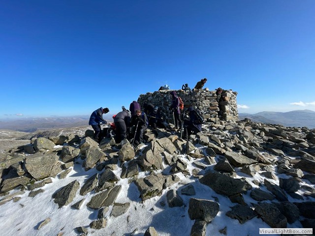
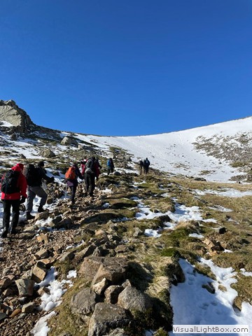
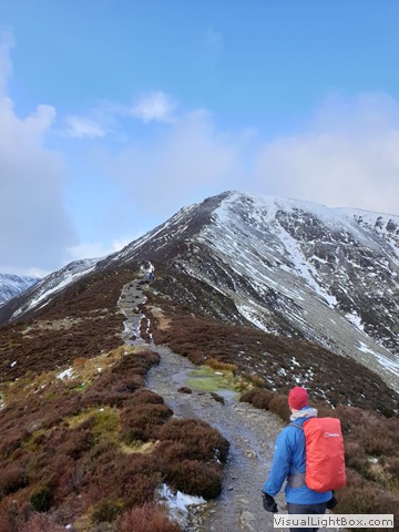
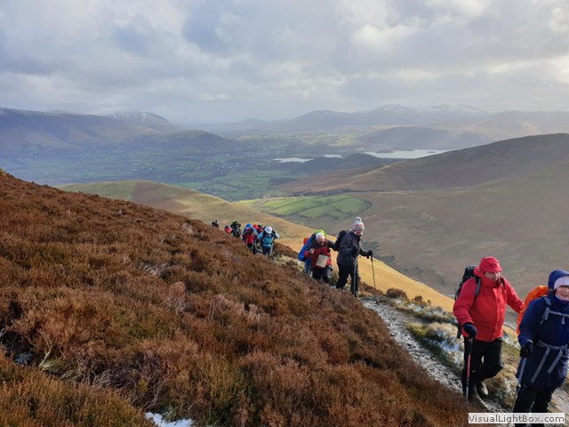
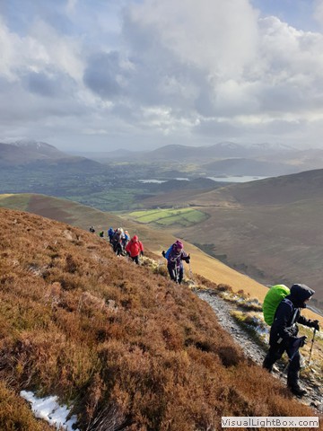
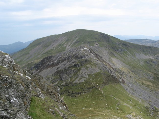
Sunday 12th October 2025 6:00am Northern Fells

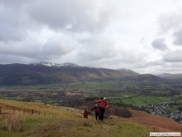
The walks cover the Lakeland Fells north of Keswick, taking in the two highest peaks in this area, Skiddaw and Blencathra (or Saddleback as it also known as). Skiddaw is the oldest mountain in the Lake District and third highest. The ascent of Skiddaw will, if the weather is kind, pro-vide excellent views of Derwent Water and Borrowdale. Wain-wright describes Blencathra as “a mountain that compels attention even from those dull people whose eyes are not habitually lifted to the hills”. All the walks end at the village of Threlkeld, an area that once had considerable lead and zinc mine workings.
Maps ………………Explorer OL4 and OL4 The English Lakes NW and NE Areas
Walk Details ……………….………………….……….……...…………Ian Broughton
Memories from the 50 years of Hill Walking Club
….. strong winds and rain on Fairfield causing Colin to get blown over and Bernard to fall and crack a tooth. ... and hold-ing onto Colin on another windy day on Mam Tor Richard G
Sunday 9th November 2025 6:00am Stanage Edge

Stanage Edge is a gritstone escarpment in the Peak District. A few miles to the west of Sheffield, the edge allows for superb views of the Dark Peak to the west. The highest point is High Neb at 458m above sea level. It was quarried in the past to make grindstones and some are still visible today, produced but never used.
Map………………………………………………………………………...Explorer OL 24
Walk Details …….………………………………………………...……....Keith Richards
Memories from the 50 years of Hill Walking Club
...Patrick being left behind at the motorway services on his first walk. Heather M
Sunday 15th December 2024 7am Goyt Valley Buxton Moors
COACH LEAVES 7.00AM
Walk Organiser – Carol Gosling
This will be our first visit to the Cavendish Golf Club for our annual dinner, giving us access to the hills and moors close to Buxton, which is situated on the edge of the Peak District National Park. All the walks are circular from the golf club.
A Walk
The A party head northwards through Corbar Woods and over Corbar Hill then turn north west to contour round Combs Moss to White Hall Centre. They turn westward, and descend to cross the dam between Fernilee and Errwood reservoirs. They ascend The Street and turn southwards over Foxlow Edge to the ruins of Errwood Hall. They head south to Goyt’s Quarry and then cross the footbridge over the River Goyt, eventually heading north and then north east over Wild Moor. They follow Wildmoorstone Brook and then head south again to climb steeply up to Burbage Edge. Then, depending on time and conditions, they descend to the golf club, either by retracing their steps a short way to Beet Wood and Watson Farm or descending to Burbage and then using the permissive path across the golf course to Watson Farm.
Leaders: Carol Gosling and Matthew Lumley Distance: 23km - Ascent 950 m
B1 Walk
The B1 party cross the golf course to Watford Farm and then ascend through Beet Wood to reach the blocked tunnel of the former Cromford and High Peak Railway. They then follow the path of the disused railway to Goyt’s Lane car park before descending to cross the dam between Fernilee and Errwood Reservoirs. They ascend The Street to Pym Chair and then turn southwards over Cat Tor to Shining Tor. They descend eastwards to cross the River Goyt and then cross the moors to Burbage and on to the golf club.
Leaders: Bob Price and Ian Broughton Distance: 19.8 km- Ascent 770m
B2 Walk
The B2 party head northwards through Corbar Woods and over Corbar Hill then turn north west to contour round Combs Moss to White Hall Centre. They turn westwards and descend to cross the dam between Fernilee and Errwood Reservoirs. They ascend the Street and then turn southwards over Foxlow Edge to the ruins of Errwood Hall. They head south to Goyt’s Quarry, cross the River Goyt and climb eastwards over the moors before descending to Burbage and back to the golf club.
Leaders: Keith and Elaine Richards Distance: 17km – Ascent 740m
C Walk
The C party cross the golf course to Watford Farm and then ascend through Beet Wood to reach the blocked tunnel of the former Cromford and High Peak railway. They then follow the path of the disused railway to Goyt’s Lane car park and continue north westwards before turning south west to descend to the Errwood Reservoir. They then follow the River Goyt before turning eastwards over Goyt’s Moss to reach Burbage and the golf club.
Leaders: Wendy Price and Neville Village Distance: 14km –Ascent 485m
Map: Explorer 24 White Peak Area
Sunday 16th February 2025 6:00 am The Quantocks

Walk Organiser – Carol Gosling
Cost of this months walk is £18 members £20 non members
The Quantock Hills run from the Vale of Taunton Deane in the south, for about 24 km to the north–west, ending at Kilve and West Quantoxhead, almost at the Bristol Channel. Characterised by deep wooded valleys or “combes”, open heathland and rolling hills, their diverse landscape is ideal for walking. Our walks will explore the ancient bridleways and paths leading to and then following the ancient ridge.
All walks finish just south of Holford in a large lay by (ST157 408) and involve some stream crossings on the final descent to Holford. No wet feet on the recce but it is recommended to have some dry socks on the coach just in case!
A Walk starts at Norton Manor Camp and then heads northwards using footpaths, bridleways and quiet lanes to the summit of Cothelstone Hill. They continue north-westwards on the Macmillan Way West to Wills Neck –at 384 metres, it is the highest point on the Quantocks. They continue on the Macmillan Way West where they detour to the summit of Black Hill and then onwards to Bicknoller Post and Beacon Hill. They head due north to descend Smiths Combe before turning east and then south to make their way back to the coach, using a selection of the many paths available.
Leaders Paul Green and Tom Somervell Distance 25k –Ascent 860m
B1 Walk begins at Seven Ash and then using footpaths, bridleways and quiet lanes, heads east to West Bagborough, then north to join the Macmillan Way West and west to Wills Neck. At 384 metres, this is the highest point on the Quantocks. They follow the same route as the A party back to Holford.
Leaders: Bob Price and Louise Tidman Distance 19.5km- Ascent 720m
B2 Walk starts on the A358 (ST137 360) just south of Crowcombe, heads east to Little Quantock Farm and then contours at the base of Great Hill to Triscombe Farm. There is then a very steep ascent to Wills Neck – at 384 metres it is the highest point on the Quantocks. They continue on the Macmillan Way West where they detour to the summit of Black Hill and then onwards to Bicknoller Post and Beacon Hill. They head due north to descend Smiths Combe before turning east to follow the Coleridge Way back to the coach.
Leaders Neville Village and Richard Gosling Distance 17.5k – Ascent 680m
C Walk starts on the A358 (ST137 360) just south of Crowcombe, heads east to Little Quantock Farm and then contours at the base of Great Hill to Triscombe Farm. They follow the lane southwards for a short distance before ascending to Wills Neck, the highest point on the Quantocks. They continue on the Macmillan Way West where they detour to the summit of Black Hill, then onwards past Lowsey Thorn to turn eastwards on Black Ball Hill. They descend through Slaughterhouse Combe, criss-crossing the stream several times, to Hodders Combe and back to the coach.
Leaders: Wendy Price and Rus Khalid Distance - 14.5km – Ascent 530m
Map: Explorer 140 Quantock Hills and Bridgwater
Memories from the 50 years of Hill Walking Club
......the very efficient reaction of security officers when a member went too close to Chequers to get a photo Heather M
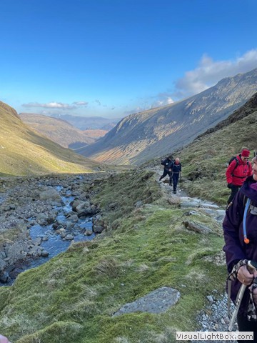
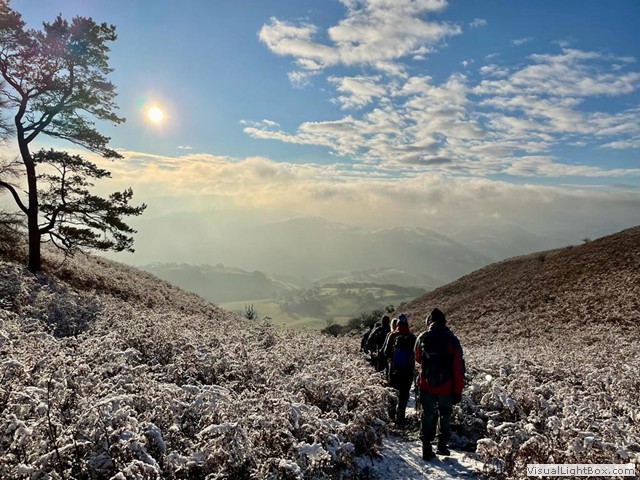
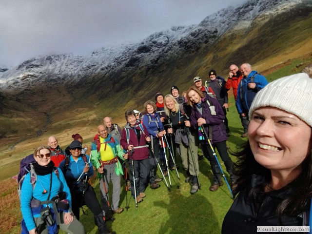
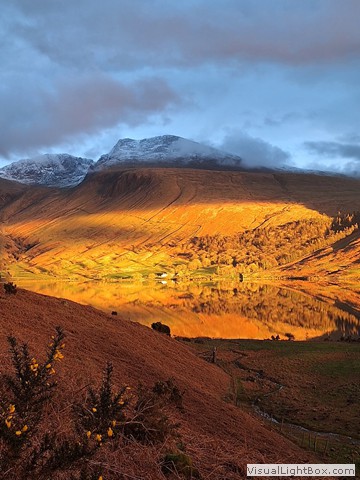
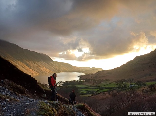
Friday 28th February– Monday 3rd March 2025 Club Weekend Lake District
.JPG)
We will be returning to the Glaramara Hotel in Borrowdale. This is in a superb location, with access to some of the highest Lakeland fells directly from the hotel. Borrowdale is one of the most beautiful valleys in England, which has inspired artists and poets, such as Wordsworth.
Details From………...…………………………………….………….Tom Somervell
Memories from the 50 years of Hill Walking Club
............Bob, Carol and me struggling up an extremely steep, near vertical hill on a Howgills recce, only to look at the map and find we should be on the next hill. Richard G
Sunday 13th April 2025 6:00am The Brecon Beacons

Walk Organisers – Wendy and Bob Price
(Cost of this walk is £18.00 for members and £20.00 for visitors)
The Brecon Beacons is made up of six main peaks, which from west to east are: Corn Du, 873m; Pen y Fan, the highest peak, 886m; Cribyn, 795m; Fan y Big, 719m; Bwlch y Ddwyallt, 754m; and Waun Rydd, 769m. These summits form a long ridge and are most impressive viewed from the Vale of Usk to the north with the summits rising above deep cwms split by long thin ridges.
The A Walk starts at the Storey Arms (SN987200) following the Cambrian Way climbs to the Obelisk at Craig Cwm Llwch, before ascending to Corn Du and then Pen y Fan, the highest point of the day. The walk proceeds to follow the ridge over the summits of Cribyn and Fan y Big, then continues eastwards around the Cwm to Bwlch y Ddwyallt before swinging south eastwards past Waun Rydd to the WW2 memorial. The descent begins over Cwar y Gigfran and around to Allt Lwyd, and continues to the Talybont Reservoir. The Taff Trail is then followed back to the finish at Talybont-on-Usk. (SO113228).
Leaders: Carol Gosling and Ranjit Bindarh
Distance: 21km Ascent: 1075m Descent: 1390m
The B1 Walk also starts at the Storey Arms (SN987200) following the Cambrian Way climbs to the Obelisk at Craig Cwm Llwch before ascending to Corn Du and onto Pen y Fan, the highest point of the day. The walk proceeds to follow the ridge over the summits of Cribyn and Fan y Big. Then continues eastwards along the ridge around the cwm to Bwlch y Ddwallt past Waun Rydd and steeply descends from Carn Pica to join the Taff Trail which is followed back to Talybont-on-Usk. (SO113228)
Leaders: Paul Burns and Louise Tidman
Distance: 18.5km Ascent: 960m Descent: 1280m
The B2 Walk also starts at the Storey Arms (SN987200) and climbs to Bwlch Duwynt, before ascending to Corn Du and continuing to Pen y Fan, the highest point of the day. The walk proceeds to follow the ridge omitting the summit of Cribyn and continuing to Fan y Big then moves eastwards along the ridge around the cwm to Bwlch y Ddwallt past Waun Rydd and steeply descends from Carn Pica to join the Taff Trail which is followed back to Talybont-on-Usk. (SO113228)
Leaders: Bob Price and Richard Gosling
Distance: 17.6km Ascent: 810m Descent: 1120m
The C Walk is circular and starts in Talybont-on-Usk (SO113228). Heading south west through Aber the walk turns west and climbs steeply to the summit of Carn Pica and continues past Waun Rydd to meet the escarpment at Rhiw Bwlch y Ddwyallt. Turning north east descends to Pen y Bryn quarries, from there turns south east and gradually descends entering the Talybont Forest to join the Usk Valley Walk; quiet lanes are then followed back to the finish at Talybont-on-Usk.
Leaders: Wendy Price and Rus Khalid
Distance: 16.5km Ascent: 700m Descent: 700m
Map: Explorer OL 12: Brecon Beacons Western Area Explorer OL17.
Memories from the 50 years of Hill Walking Club
….. Bob ,slipping in a very wet, muddy patch on our descent from Red Screes on a Lakes recce-and then, at my rather tongue in cheek suggestion, rolling on the grass to clean up. Carol G
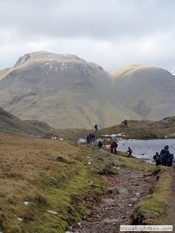
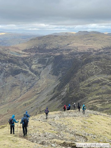
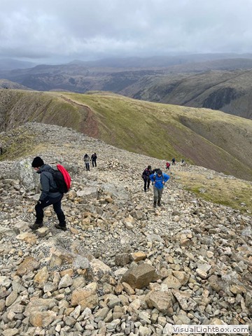
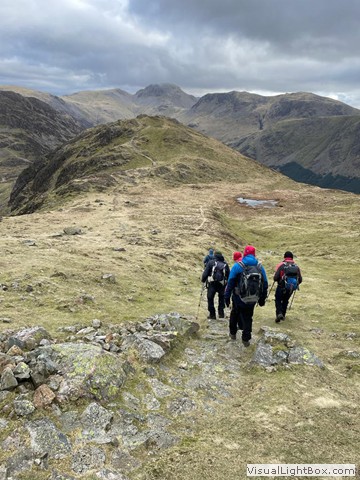
Sunday 11th May 2025 6:00am High Street Area

Cost of this walk is £20.00 for members and £22.00 for visitors
Walk Organisers – Wendy and Bob Price
High Street is a fell in the Lake District. At 828 metres, its summit is the highest point in the far eastern part of the national park. It is located southwest of Ullswater and it is one of the most visited in this quiet part of the Lakes. The fell is named after the Roman road which snaked its broad back and ran over the summit. All walks finish at The Brotherswater Inn (NY403119).
The A Walk starts from near Hartsop (NY405132) and climbs steeply to the summit of Hartsop Dodd then follows the ridge to the summit of Stoney Cove Pike, from there descends gradually then very steeply via a scramble to Threshthwaite Mouth. The walk climbs steeply after that along a loose rocky path to Thornthwaite Beacon then across undulating fells over the summits of High Street (at 828m the highest point of the day), The Knott, Rest Dodd and Angle Tarn Pikes. The walk then descends via Boredale Hause to Brotherswater and proceeds to the finish at The Brotherswater Inn.
Leaders: Carol Gosling and Tom Somervell Distance: 19km Ascent: 1190m Descent: 1180m
The B1 Walk starts at The Brotherswater Inn and climbs steeply to the summit of Caudale Moor and Stoney Cove Pike, after which descends gradually then very steeply by means of a scramble to Threshthwaite Mouth. The walk climbs steeply after that along a loose rocky path to Thornthwaite Beacon then across undulating fells over the summits of High Street (at 828m the highest point of the day) The Knott and Satura Crag. The walk then continues to Angle Tarn Pikes and descends via Boredale Hause towards Hartsop and proceeds to the finish at The Brotherswater Inn.
Leaders: Bob Price and Keith Richards Distance: 16.5km Ascent: 1025m Descent: 1025m
The B2 Walk is circular and starts at The Brotherswater Inn passing Brotherswater and continuing through Hartsop and gradually ascending along the valley track towards Hayeswater, crosses the foot bridge and climbs to the summit of The Knott. The walk proceeds to Rampsgill Head followed by the summits of Kidsy Pike, High Street (at 828m the highest point of the day) and Thornthwaite Crag. A loose, steep, rocky descent follows to Threshthwaite Mouth, the walk then climbs to Stoney Cove Pike via a steep easy scramble continuing over Caudale Moor, followed by a steep descent to the finish at The Brotherswater Inn.
Leaders: Ian Broughton and Neville Village Distance: 15.5km Ascent: 1020m Descent: 1020m
The C Walk also starts from near Hartsop (NY405132) and gradually ascends along the valley track towards Hayeswater, crosses the foot bridge turns NE and climbs to join the path from the Knott. The walk then continues to Satura Crag past Angle Tarn and climbs to the summit of Angle Tarn Pikes, then descends via Boredale Hause towards Hartsop and proceeds to the finish at The Brotherswater Inn.
Leaders: Wendy Price and Rus Khalid Distance: 12km Ascent: 550m Descent: 530m
Map: Explorer OL 5: English Lakes – North Eastern Area.
Memories from the 50 years of Hill Walking Club
...the coach driver taking us over the Grade II listed historic bridge at Hay-on-Wye with a weight limit of 7.5tons, to be met by an irate toll keeper and issued with a hefty fine. Carol G